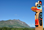
Information for visitors to the Newfoundland Island region
of the Canadian Province of Newfoundland annd Labrador.
Quick Facts About Newfoundland Island
POPULATION: Greater than 470,000
SIZE: About 42,030 square miles
LARGEST TOWN: Saint John's (Population > 200,000)
HIGHEST POINT: Cabox Mountain (about 2670 feet above sea level)
LONGEST RIVER: Exploits River (About 150 miles long)
PROVINCE: Newfoundland and Labrador Province
REGION: Off the Eastern Atlantic Coast of Canada
BODY OF WATER: Atlantic Ocean
Wikipedia Introduction to Newfoundland Island
Article with general information and facts about the island of
Newfoundland. Includes its history, flags, settlements,
points of interest, fauna, flora, and representation in fiction.
WikiTravel Newfoundland Island Articles
-
Central Newfoundland WikiTravel Article
-
Eastern Newfoundland WikiTravel Article
-
Southern Newfoundland WikiTravel Article
-
Western Newfoundland WikiTravel Article
Attractions on Newfoundland Island
- Avalon Wilderness Reserve
- Cataracts Provincial Park
- Chance Cove Provincial Park
- La Manche Provincial Park
Towns and Cities on Newfoundland Island
- Conception Bay South (largest town on Newfoundland Island)
- Corner Brook (pulp and paper industry, transportation hub)
- Gander (Gander International Airport, former WWII airfield)
- Grand Falls-Windsor (Salmon Festival, Central Newfoundland Island's largest town)
- Happy Valley-Goose Bay (military town)
- Mount Pearl (second largest city in Newfoundland, west edge of St. John's)
- St. John's (capital of the Newfoundland and Labrador Province)
- Stephenville (Newfoundland Intl Airport, gateway to port of Port Peninsula)
- Twillingate (fishing towns spread over two small islands off Newfoundland Island)
Newfoundland and Labrador Attractions
Newfoundland and Labrador Travel
Canada Travel Guide
North America Travel Guide

