Information for visitors to the Azua Province in the southof the Dominican Republic.
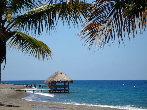
The Provionce of Azua is situated on the Bay of Ocoa, on the southwest coast
of the Dominican Republic.
Quick Facts About the Azua Province
ESTABLISHED: 1844
POPULATION: Greater than 298,000
SIZE: About 980 square miles
MAXIMUM ELEVATION: About 270 feet above sea level
POSTAL CODE 71000
CAPITAL CITY:
Azua de Compostela
REGION:
Valdesia Region
DEPARTMENT:
Southwest Department
LOCATION: Southeast coast and Interior regions
Attractions in the Azua Province
- Small western section of Valle Nuevo National Park
- Small southeast section of Armando Bermudez National Park
- Borders the Sabana Yegua Reservoir and Dam
- Puerto Viejo de Azua (seaport 18 miles SW of Azua Municipality)
- Bahia de Jura (Jura Bay)
- Bahia de Ocoa (Ocoa Bay)
- Ocoa River (flows into he Caribbean south of Palmar de Ocoa)
- Playa Blanca / Blanca Beach
- Playa Los Negros / Los Negros Beach
- Playa Monte Rio / Monte Rio Beach
- Playa la Caobita
Palmar de Ocoa
Coastal fishing town situated at the Caribbean Sea mouth
of the Ocoa River.
POPULATION: Greater than 2,000
-
Palmar de Ocoa Dot Com
-
Air BnB: Palmar de Ocoa Lodging
-
Villas Dot Com: Palmar de Ocoa Lodging
Ibiza Hotel (Palomar de Ocoa)
- On the beach in thefishing village of Palmar de Ocoa
- Situated between Azua and Bani on the Bay of Ocoa
- 40 kilometers from both Bani and Azua de
- 12 rooms, on the beach, pool, restaurant
Playa Mia Hotel (swimming pool, beach) for sale ad
All Municipalities in the Azua Province
Azua de Compostela | pop > 128,200 | about 160 square miles |
----- Barreras Municipal District
----- Barro Arriba Municipal District
----- Clavellina Municipal District
----- Emma Balaguer Viuda Vallejo Municipal District
----- Las Barias-La Estancia Municipal District
----- Las Lomas Municipal District
----- Los Jovillos Municipal District
----- Puerto Viejo Municipal District
-
Estebania | pop > 10,100 | about 60 square miles |
-
Guayabal | pop > 3,900 | about 100 square miles |
-
Las Charcas | pop > 9,200 | about 100 square miles |
----- Hatillo Municipal District
----- Palmar de Ocoa Municipal District
-
Las Yayas de Viajama | pop > 7,100 | about 180 square miles |
----- Hato Nuevo-Cortes Municipal District
----- Villarpando Municipal District
-
Padre Las Casas | pop > 40,500 | about 190 square miles |
----- La Siembra Municipal District
----- Las Lagunas Municipal District
----- Los Frios Municipal District
-
Peralta | pop > 8,500 | about 45 square miles |
-
Pueblo Viejo | pop > 8,200 | about 18 square miles |
----- El Rosario Municipal District
-
Sabana Yegua | pop > 26,500 | about 40 square miles |
----- Ganadero Municipal District
----- Proyecto 2-C Municipal District
----- Proyecto 4 Municipal District
-
Tabara Arriba | pop > 14,200 | about 80 square miles |
----- Amiama Gomez Municipal District
----- Los Toros Municipal District
----- Tabara Abajo Municipal District
More About the Azua Province
Wikipedia "Azua Province" Article
Article with general informationand facts about the
Azua Province of the Dominican Republic. Includes
the province's municipalities, municipal districts,
population, and related resources.
YouTube Azua Province Video
Bordering the Azua Province
-
Baoruco Province
-
Barahona Province
-
La Vega Province
-
Peravia Province
-
San Jose de Ocoa Province
-
San Juan Province
Southwest Dominican Republic
South Coast of the Dominican Republic
Dominican Republic Travel Guide
Caribbean Travel Guide


